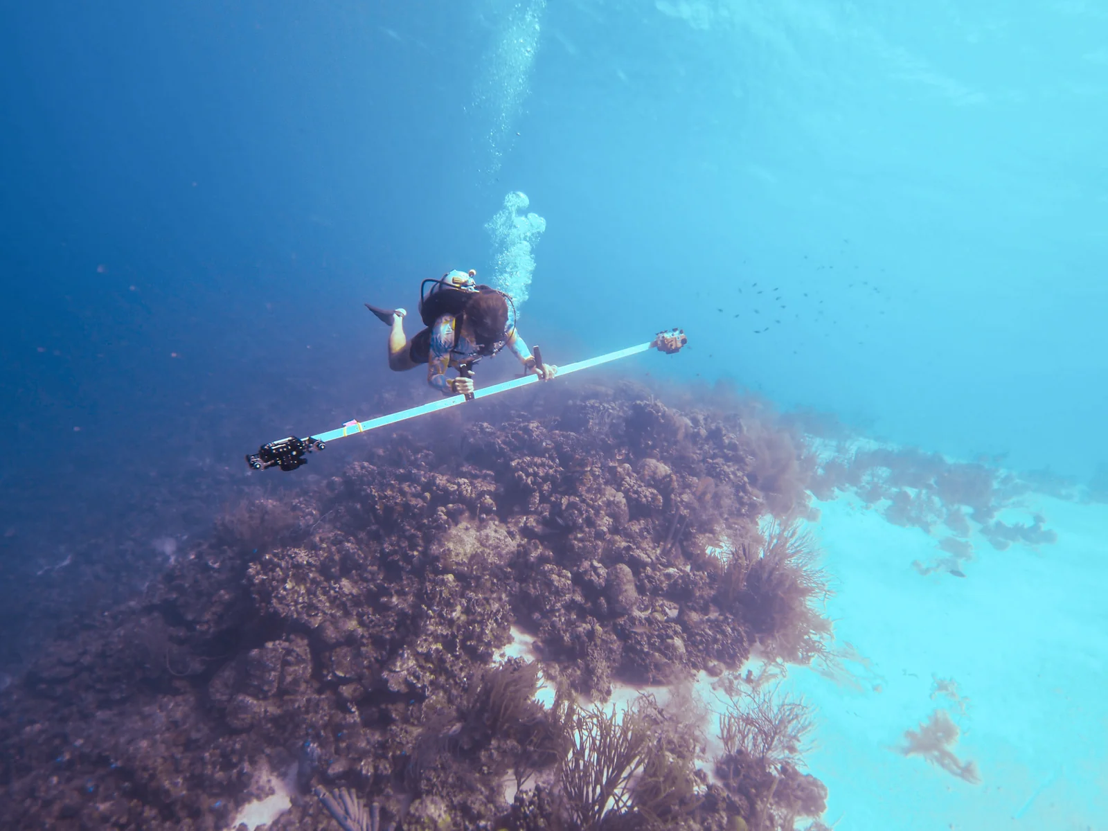
While living on Bonaire in 2023, I looked for a coral-research project to contribute to. Photogrammetry experience from California kelp-restoration plots of about 100 m² prompted a question: could I adapt the method to reef sections closer to 2,000 m²?
With STINAPA, I developed custom camera rigs, survey markers, capture routines, and processing methods to build a photographic reef baseline. In 2026, I returned to lead the next campaign. That workflow turns thousands of overlapping photographs into reef maps and models.
A reef that could not wait
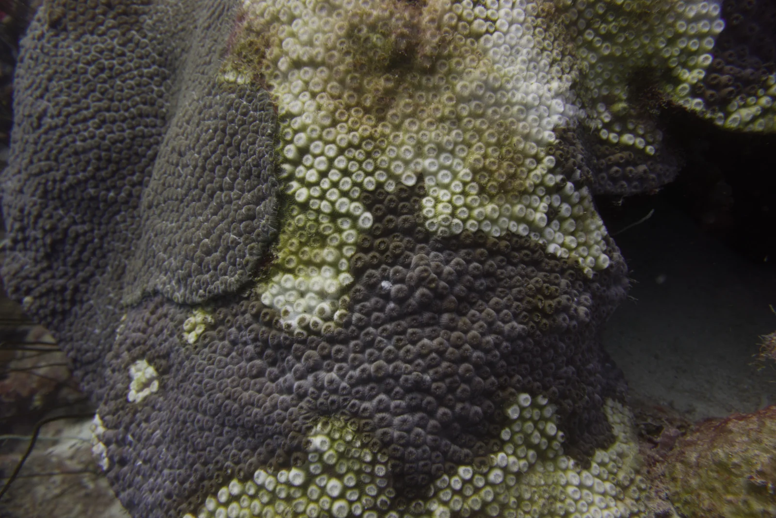
Stony Coral Tissue Loss Disease reached Bonaire in 2023. The reefs were changing as I photographed them, making a detailed record urgent: it could preserve conditions and structure we would never see again.
Future researchers can revisit those scenes, inspect reef structure and visible conditions, and ask questions that were not part of the original dive.
Designing a method I could use underwater
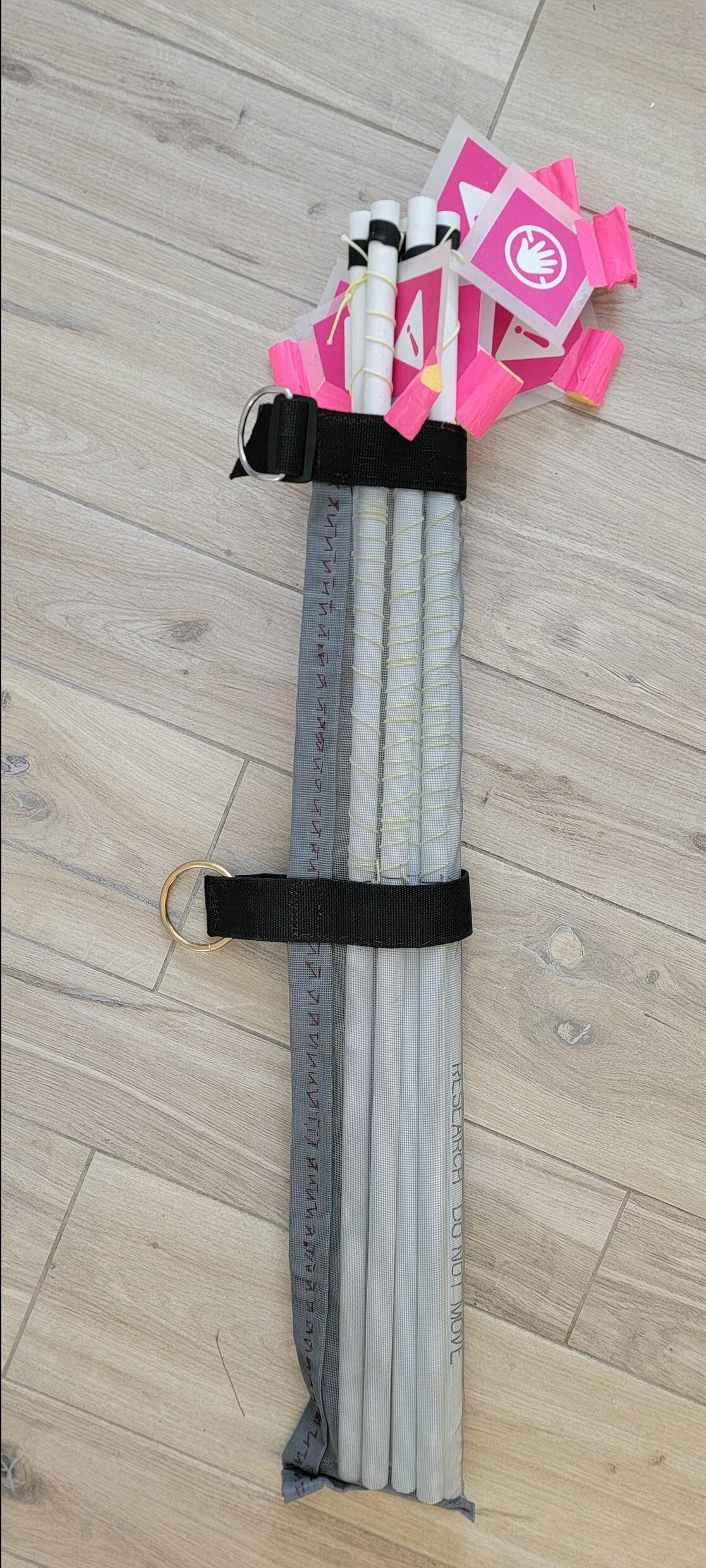
I built a camera rig, markers, and carrying system, then developed a swim method connecting photographic coverage with surface GPS positions. Everything had to be practical to carry, deploy, and retrieve underwater.
The 2026 protocol pairs overlapping camera passes along reef contours, from deep to shallow, with a second diver establishing boundaries, deploying and retrieving scale bars, and recording reference depths.
Overlapping photographs reconstruct the scene; scale bars supply local measurements, and surface GPS positions guide return visits. Together, they make the survey easier to interpret after the dive.
A continuing partnership with STINAPA
A continuing partnership grew with STINAPA, whose research informs management of Bonaire’s protected environments. Our aim was a detailed archive that could support repeat surveys and new research questions.
Some early reef maps exceeded 10 GB each. Sharing them and dividing them into workable sections for annotation became obstacles after capture. Making the record useful to STINAPA meant designing the processing, organization, and access alongside the underwater method.
The 2026 campaign continued the partnership, returning to baseline locations to add a second set of scans and a documented collection for STINAPA.
Returning to the sites in 2026
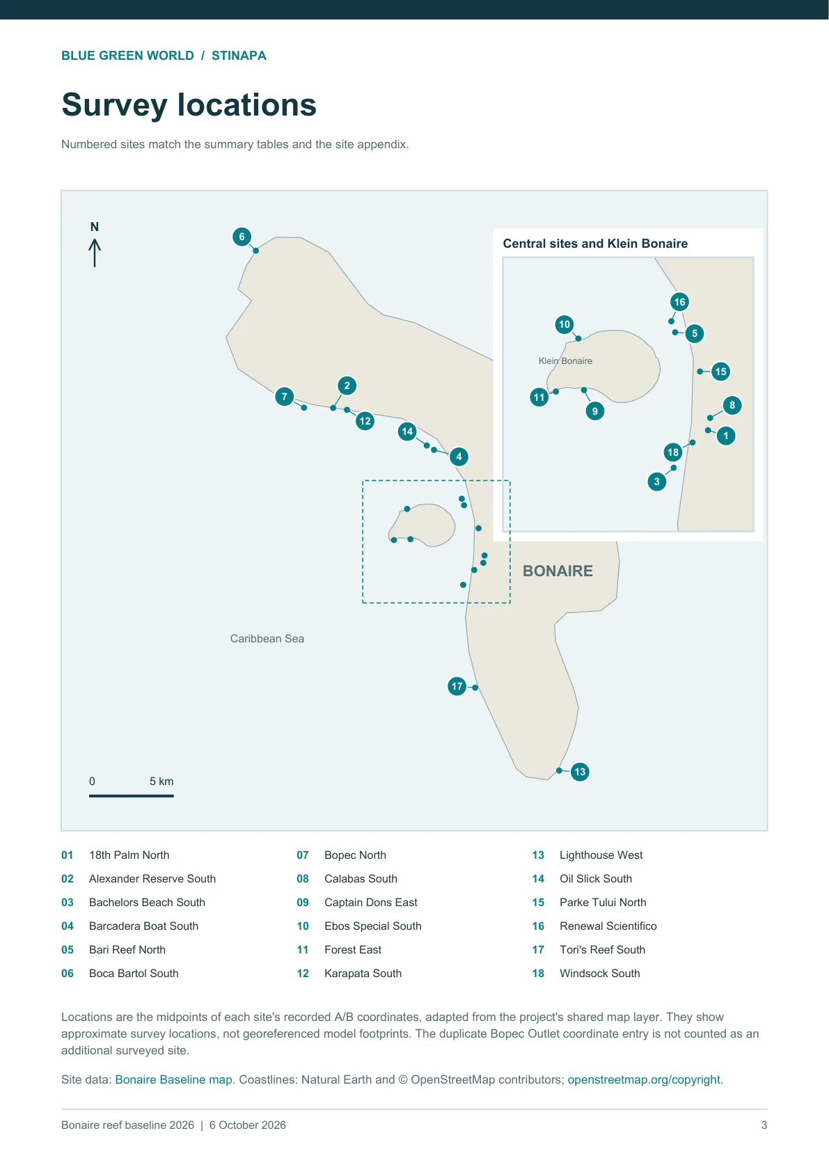
From 15 August to 4 October 2026, I led surveys at 18 Bonaire and Klein Bonaire sites. We used earlier GPS coordinates to plan coverage that included the original scan edges.
Boundaries can vary between visits. Field notes record changes to access, markers, and site definitions; comparing models requires a further alignment step.
- 18 reef sites around Bonaire and Klein Bonaire.
- 70,885 source photographs.
- Approximately 34,160 m² of reef-facing mapped area.
Leaving a record that can be used again
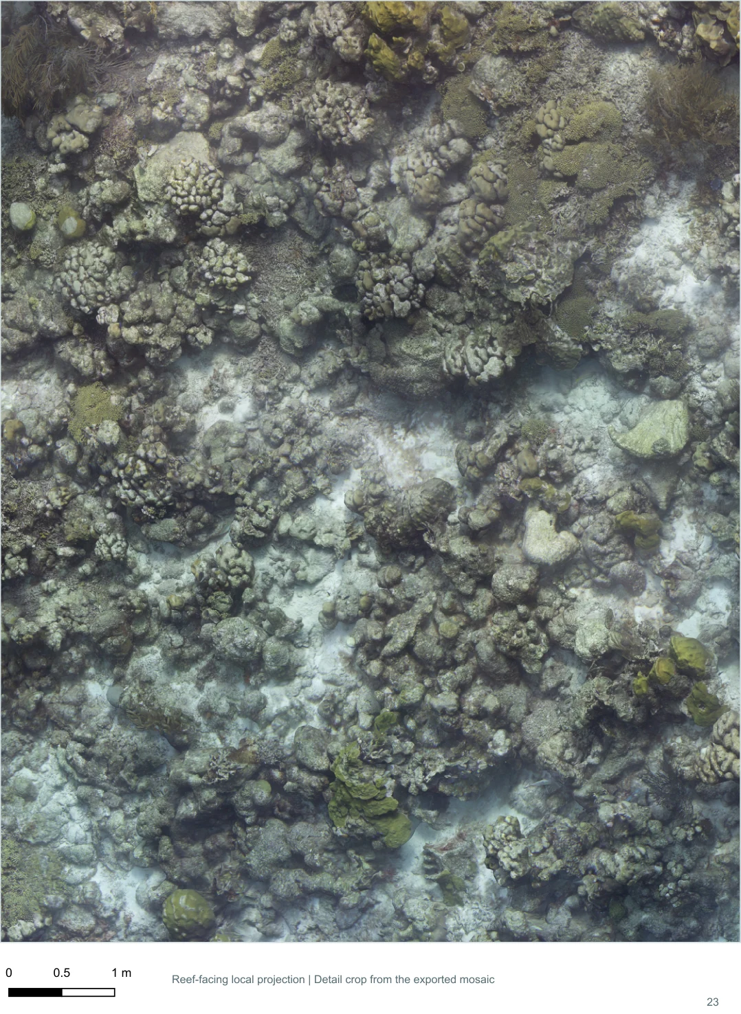
The archive includes original photographs, editable Metashape projects, reef-facing orthomosaics, QGIS projects, and site reports, accompanied by GPS, depth, scale, calibration, and field records.
The 2026 survey report connects methods, locations, coverage, and image counts with individual reports for all 18 sites. Readers can move from the campaign overview into the evidence for a particular reef.
Next comes aligning surveys across years and developing comparative research with STINAPA. The detailed baseline remains available for that work and future researchers’ questions.
Read the full 2026 survey report
Deeptime explains the automation behind the reconstruction workflow.